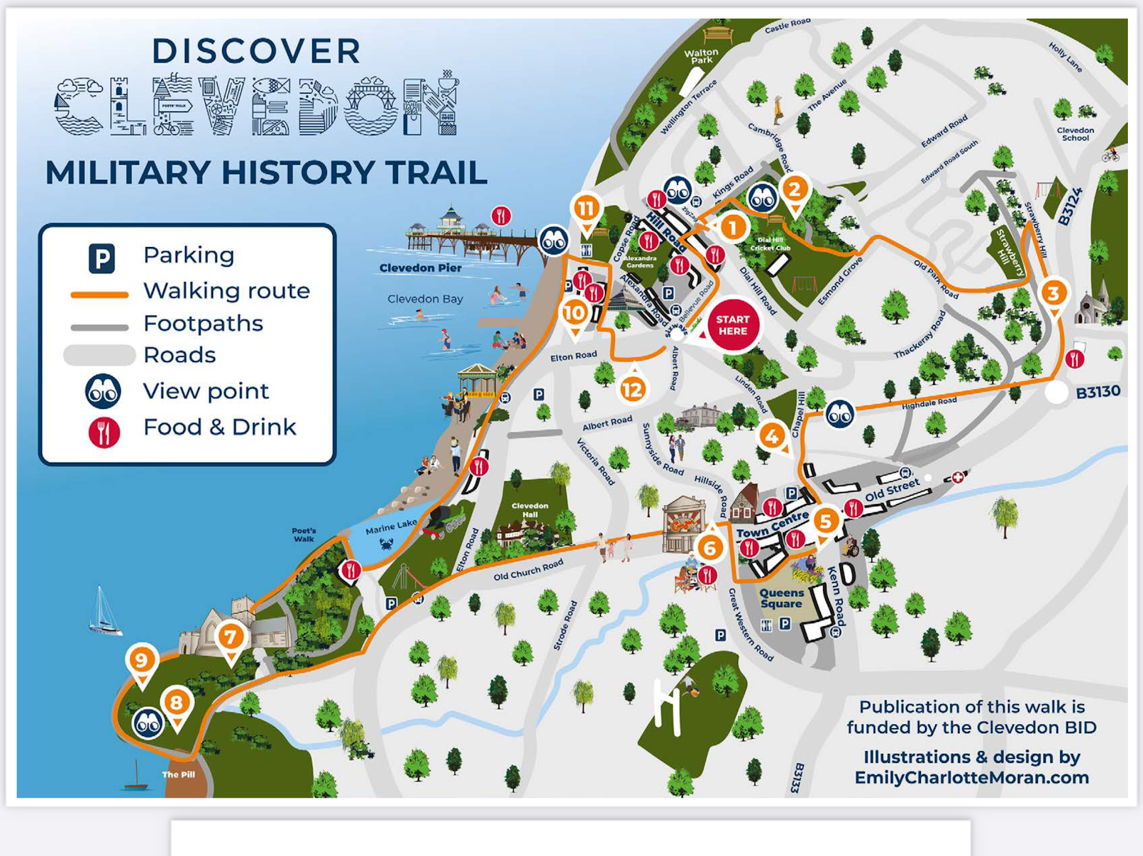
Or as the Russian's call it, 'Kholm'. During the first week of December 1941 Marshall Zhukov launched Operation Typhoon and, in combination with appalling weather, pushed the invading German army back from the gates of Moscow. In the North on the Southern Flank of Heeresgruppe Nord the German 16th Army reeled under the blow, conceding ground but not the two primary routes through the swamps covering the area between the lakes of Seeliger and Ilmen. These routes ran through the towns of Demjansk and Kholm. At Kholm a force of just 5,500 men under the command of Major General Theodor Scherer, though completely surrounded, held out for 105 days withstanding 100 infantry attacks (42 of which were supported by tanks). When the garrison was relieved, only 1,200 survivors remained. Throughout the ordeal the besieged men were supplied by air, and in the absence of heavy weapons, were supported by artillery 10 miles away in the main German lines. Following this epic battle Scherer was awarded a Knight's Cross and his men were feted as heroes all over Germany.
 |
| Kholm War Memorial |
Our small group walked the line of the final 'kessel' perimeter. It rained all day long but that didn't dampen our spirits - for, with a little imagination, it was easy to project back to the time of the siege Dec 1941 to May 1942. The huge Soviet War Memorial lies close to the site of the original GPU (during the siege a hugely important German strongpoint). I found myself reflecting on the appalling fate of the local Jewish population noting that the site of their destroyed synagogue was nearby.
The Soviet war memorial is sited on the eastern bank of the River Lovat and walking north, one can quickly discern some of the features apparent in contemporary photographs and first hand accounts; the 'Rote Ruine', 'Lausepelz', the site of the original church and the depths of the 'Policeman's Ravine'. Standing on the cliff top one can gaze across the Lovat to the eastern bank and reflect on the epic 105 day siege. it is relatively easy to scramble down to the river bank and see where the 1941/42 bailey bridge was sited.